http://geography.about.com/od/understandmaps/a/map-types.htm
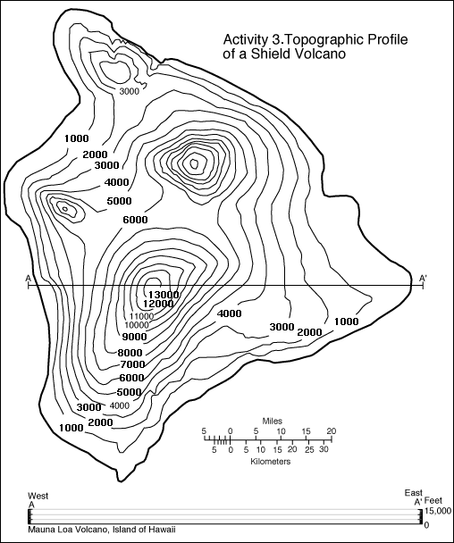
A Topographic Map is a type of contour map that uses contour lines to portray relief, shape, and elevation of the land. They capture three dimensional aspects of terrain on a two dimensional surface. Hills, cliffs, ridges, and valleys are just a few features denoted by topographic maps. When the contour lines are closer together, the change in the third dimension is largest. This map represents the Big Island of Hawaii. The coastal areas are flatter, represented by the contour lines being farther apart, and the steeper areas can be seen by the closely spaced contour lines.
No comments:
Post a Comment